Well site design
Precise coordinate positioning of features while performing editing operations in the geodatabase
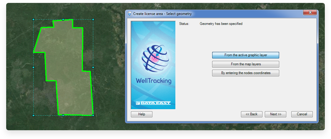
Designing lease area
Lease areas can be created using three methods of setting geometry: from active graphic layer, from map layers, or by entering nodes coordinates.
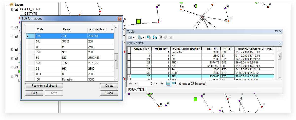
Creating formations library
In terms of WellTracking, formation is not a spatial object and so does not have geometry - it is a record in the FORMATION attribute table.
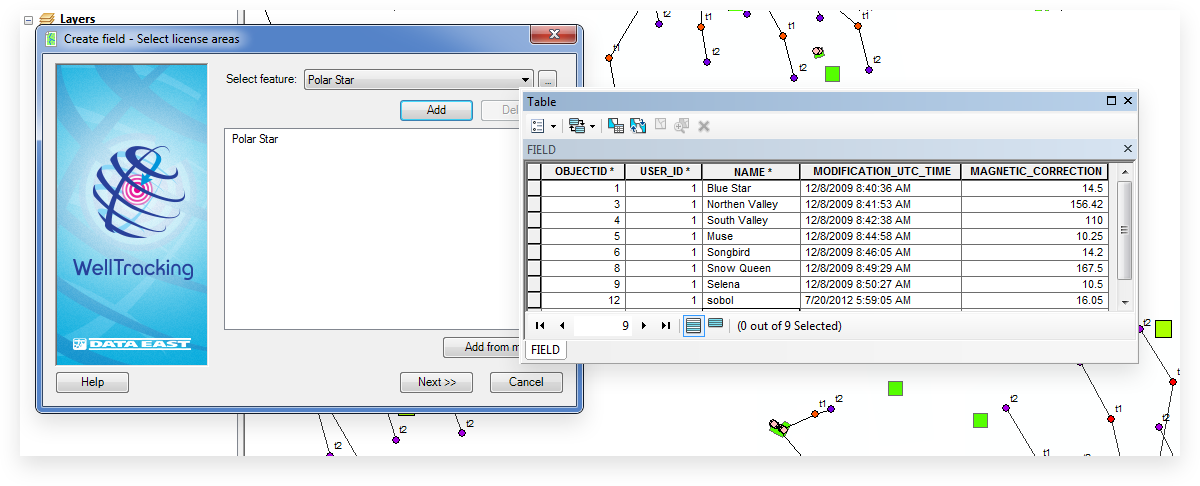
Designing field
In terms of WellTracking, field is not a spatial object and so does not have geometry - all information about the field is stored in the FIELD attribute table.
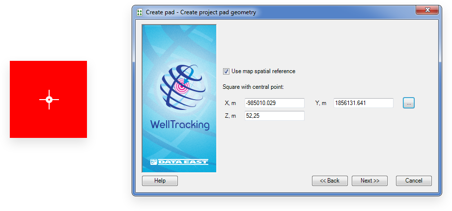
Designing pad area
The default project pad geometry is a square with center point specified by the user.
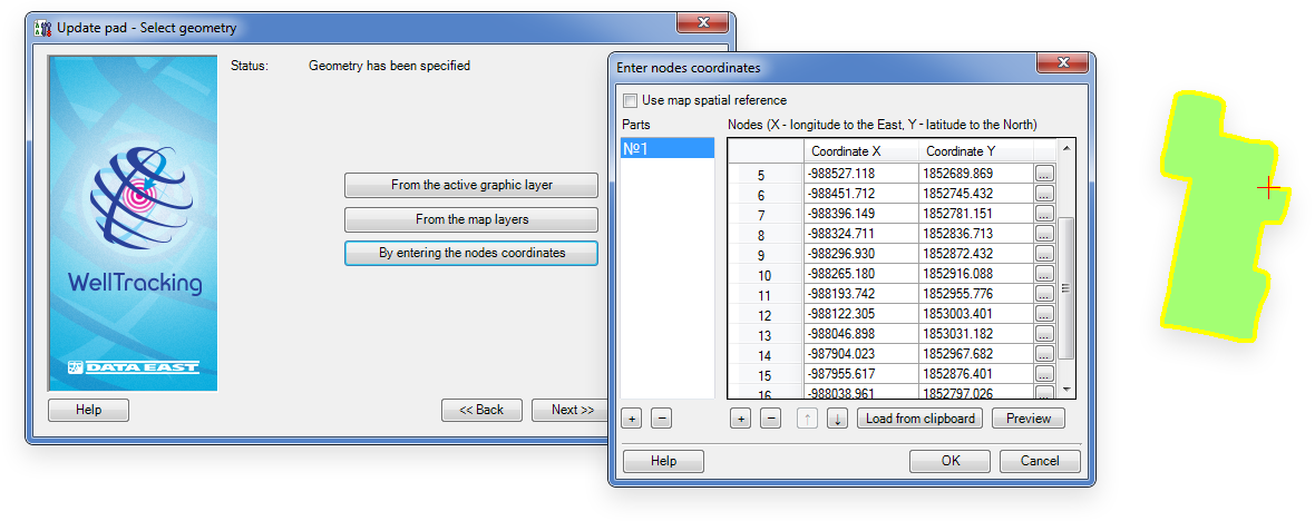
Updating pad area geometry
Upon completion of filling work for pad area, its real coordinates become known. The ready area geometry can be updated in geodatabase using following methods: from active graphic layer, from map layers, or by entering nodes coordinates.
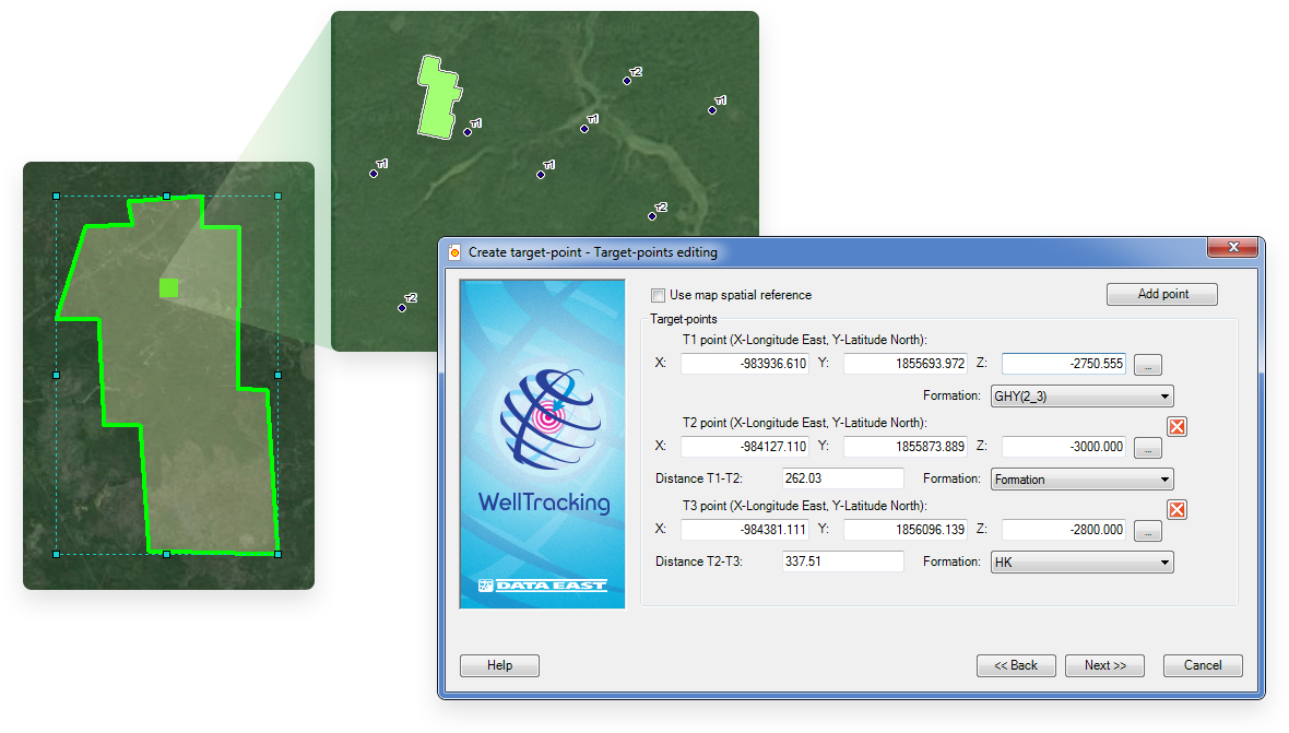
Designing project bottomhole location
The target-points coordinates should be specified in coordinate system of the geodatabase or the map. While creating target-point the project wellbore is created, for which the profile, purpose, status and tolerance parameters are specified.
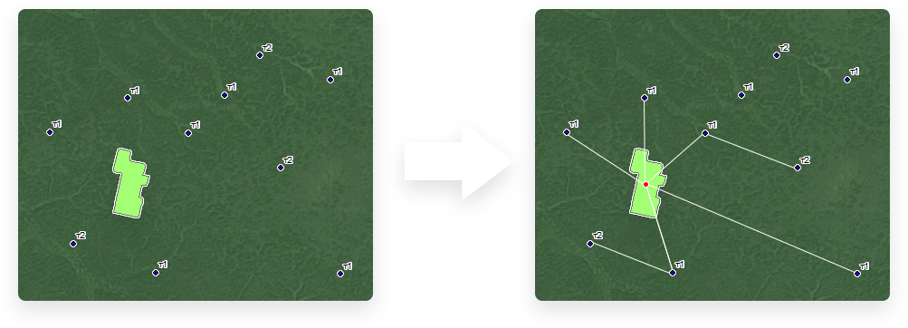
Tying project well to pad area
Creating relation between project wellbore and pad area.