Проектирование
Точное координатное позиционирование объектов при проведении операций редактирования в базе геоданных
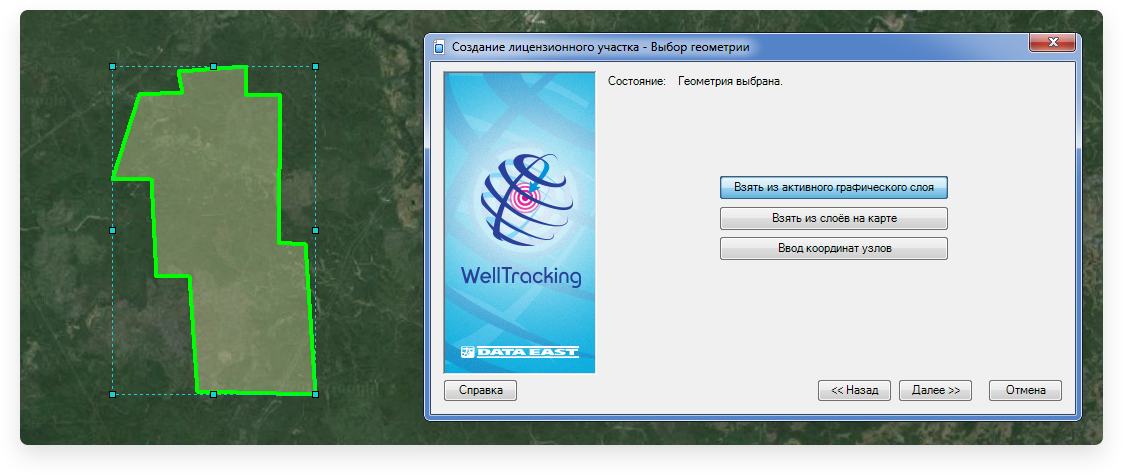
Проектирование лицензионного участка
Лицензионные участки могут быть созданы при помощи геометрического объекта, геометрии полигона на карте или ввода координат узлов.
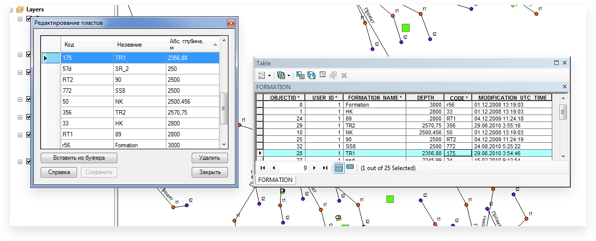
Создание библиотеки пластов
В терминах WellTracking пласт не имеет геометрии и представляет собой только запись в таблице Пласт (FORMATION).
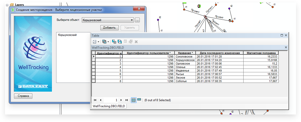
Проектирование месторождения
В терминах WellTracking месторождение не является пространственным объектом и не имеет геометрии, а вся информация о месторождении хранится в таблице FIELD.
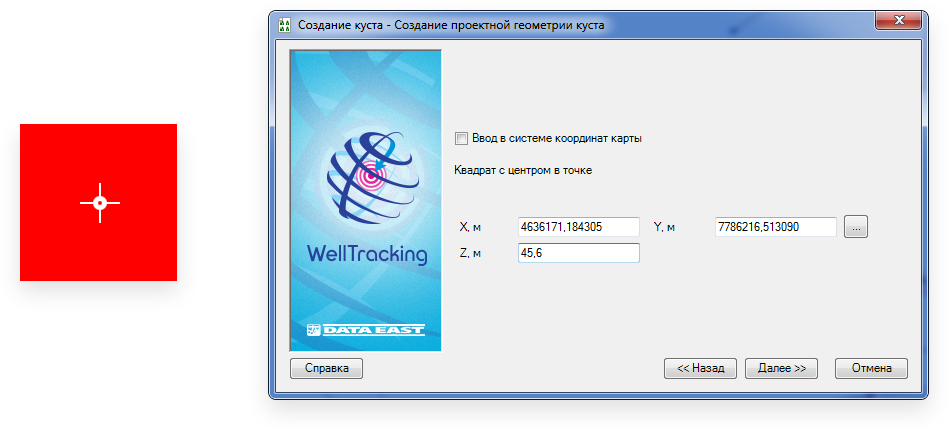
Проектирование кустовой площадки
Проектной геометрией куста по умолчанию является квадрат с центром в точке, задаваемой пользователем.
Обновление геометрии кустовой площадки
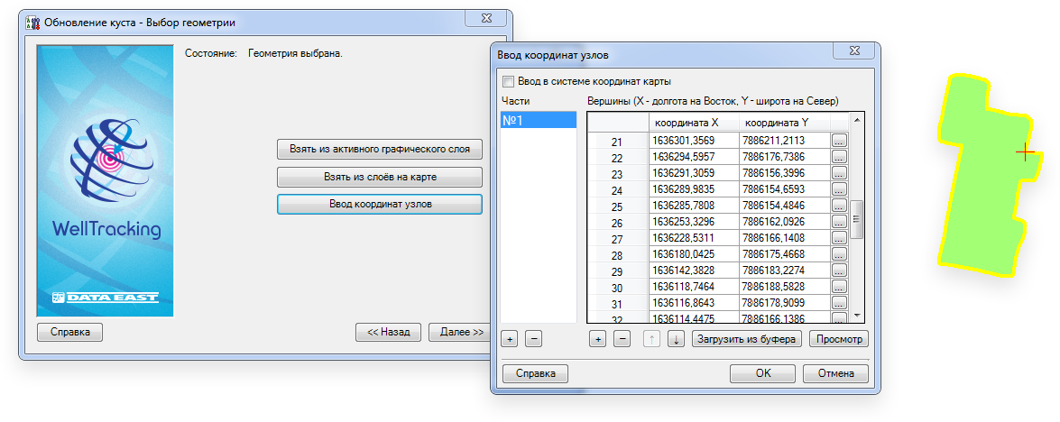
После отсыпки кустовой площадки появляется информация о ее реальных координатах. Обновить геометрию готовой кустовой площадки в базе данных можно при помощи графического объекта, геометрии полигона на карте, или ввода координат узлов.
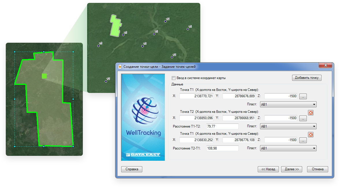
Проектирование точки проектного забоя скважины
Координаты точек-целей должны быть в системе координат базы геоданных или карты. В процессе создания точки-цели создается проектный ствол скважины, для которого указывается профиль, назначение, состояние и зона допуска.
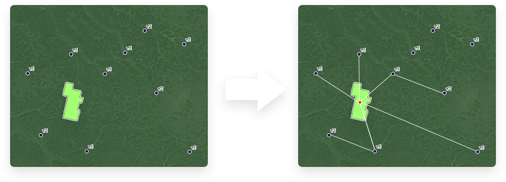
Привязка проектной скважины к кустовой площадке
Создание связи проектного ствола скважины и кустовой площадки.