Маркшейдерская документация
WellTracking предлагает 10 типов отчетов форматов *.doc, *.xls, которые можно получать на любых этапах маркшейдерских работ.
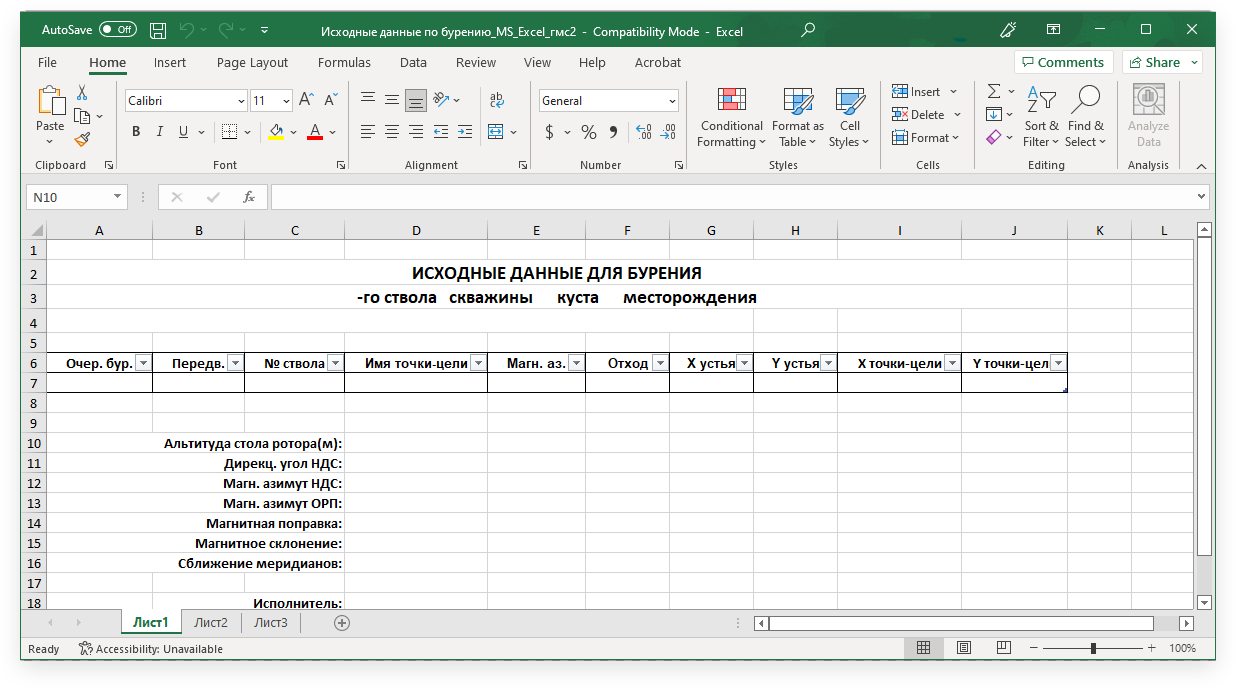
Отчет «Исходные данные по бурению скважины» содержит необходимые сведения для бурения ствола скважины.
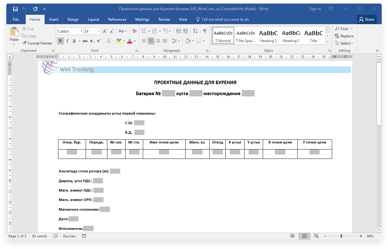
Отчет «Проектные данные для бурения батареи» содержит информацию о порядке разбуривания устьев скважин на батарее.
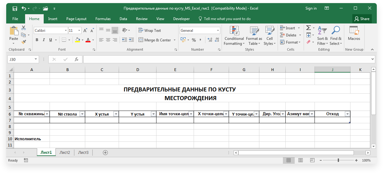
Отчет «Предварительные данные по кусту» предназначен для определения очередности разбуривания кустовой площадки.
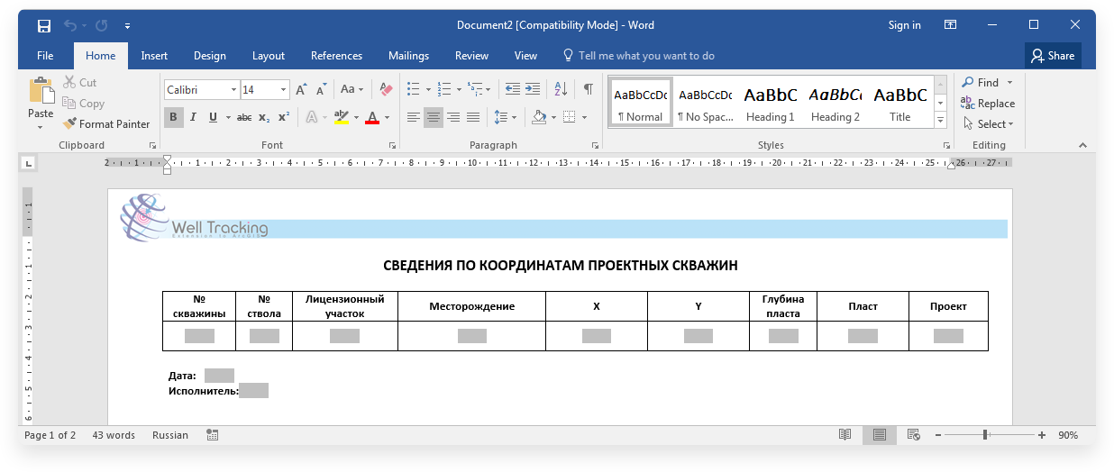
Отчет «Сведения по координатам скважин» содержит координаты проектных скважин.
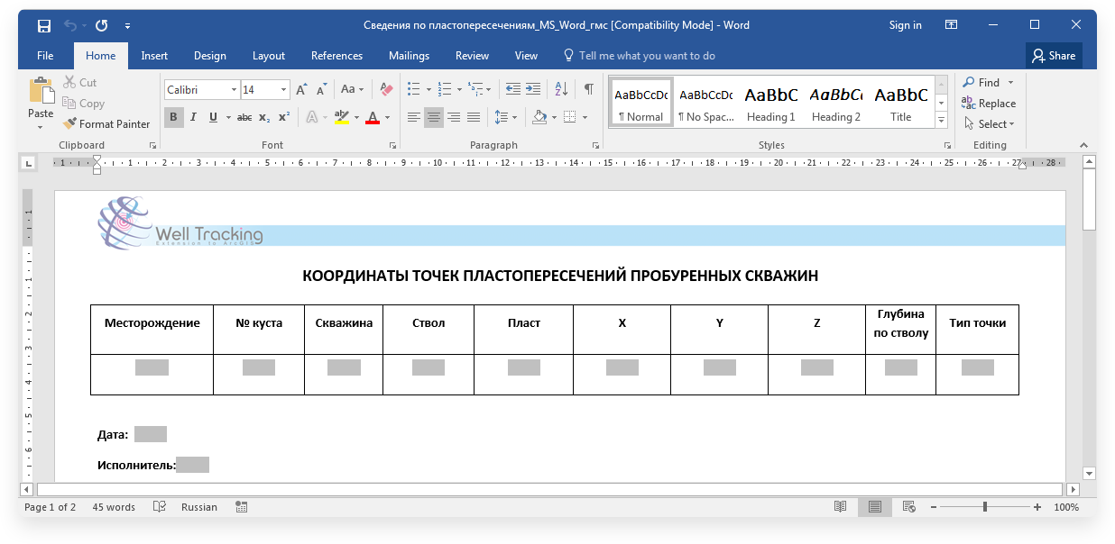
Отчет «Сведения по пластопересечениям» содержит координаты точек пластопересечения и фактического забоя скважины.
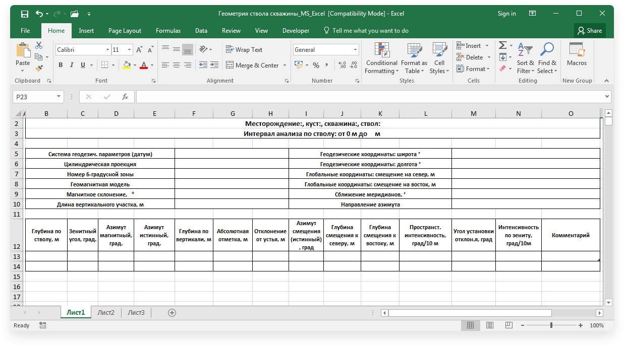
Отчет «Геометрия ствола скважины» предназначен для экспорта пробуренных и проектных стволов (геотип «План-программа») в таблицу .xlsx.
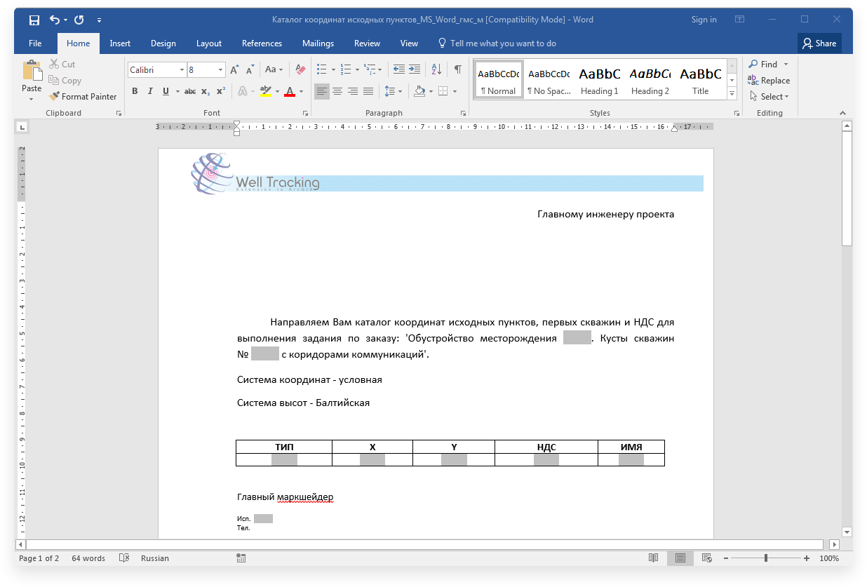
Отчет «Каталог координат исходных пунктов» содержит координаты по первым скважинам и НДС выбранных кустов.
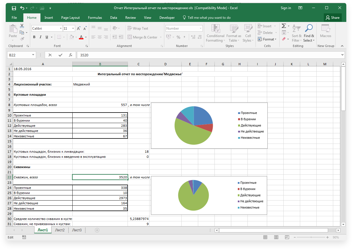
«Интегральный отчет по месторождению» отображает статистические данные по месторождению.
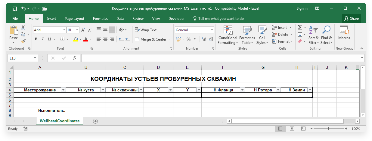
Отчет «Координаты устьев скважин» отображает координаты устьев пробуренных скважин.
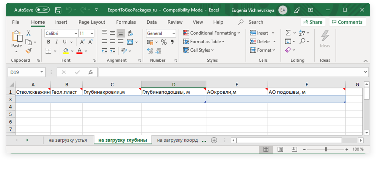
Отчет "Экспорт в геологические пакеты" содержит данные о точках пластопересечений.