Unified corporate data storage
Unified spatial data storage
WellTracking allows managing drilling data access and so solving potential security issues. All spatial drilling data, including archive data are available for work and structured based on specific requirements of drilling workflow.
Unified corporate geodatabase simplifies interaction between company departments and production units.
Unified calculation methods, unified data format, and input data verification result in creating complete and accurate well site model.

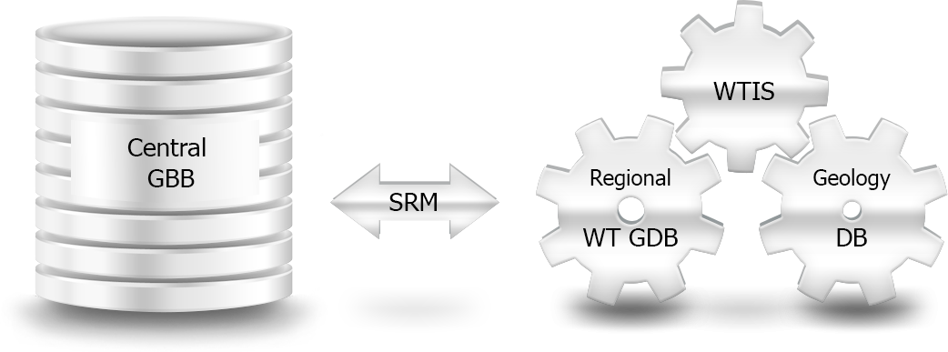
Integration to existing company infrastructure
WellTracking can be seamlessly integrated to existing infrastructure of the company. Such unified corporate data management system is created using WellTracking Interoperability Service API and Smart Replication Module.
The system provides solutions for following major data management problems:
- Gathering, editing, and storing data in local or regional geodatabase via ergonomic software toolkit
- Exchange of drilling data and interoperability with the existing information systems via WellTracking Interoperability Service API.
- Transfer of drilling data stored in various regional divisions of the company to centralized corporate geodatabase via smart replication technology.
With WellTracking all company departments and production units are provided with comprehensive geodatabase containing relevant and accurate drilling data in convenient formats. Thus, it allows organizing transparent and effective interaction process and increasing general business manageability.